ENNISKILLEN
From Atlas and Cyclopedia of Ireland (1900)
« County Dublin | Book Contents | County Galway »
Description of County Fermanagh | Enniskillen | Tully Castle, Lough Erne | Devenish Island | Fermanagh Map
HIGH STREET, ENNISKILLEN.—Enniskillen, the county town of Fermanagh, is situated on an island of 62 acres in the river connecting the upper and lower Loughs Erne. It consists principally of one long street, with a tall church spire as the chief figure. The town is noted for the part taken by its inhabitants in the Revolution of 1688-90. Originally it was the stronghold of the Maguires, who retained possession of it down to 1612, when James I. "granted" it to one Cole, whose descendants possess the major portion of it still. The town is connected with the mainland by bridges, and is attractive and striking in its appearance and surroundings. It has always been regarded as an important military position, commanding the route from Ulster to Connaught. The British military barracks at present occupy the site of one of the ancient castles of its former possessors.
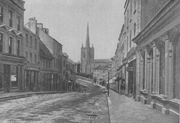
Enniskillen High Street
Description of County Fermanagh | Enniskillen | Tully Castle, Lough Erne | Devenish Island | Fermanagh Map