MAP OF COUNTY LOUTH
From Atlas and Cyclopedia of Ireland (1900)
« County Longford | Book Contents | County Mayo »
Description of County Louth | Drogheda | St. Lawrence's Gate, Drogheda | Mellifont Abbey | Celtic Cross, Monasterboice | Louth Map
For a fully magnifiable version of the County Louth map in PDF format click here. Please note that PDF documents require a reader such as Adobe Acrobat which can be downloaded here.
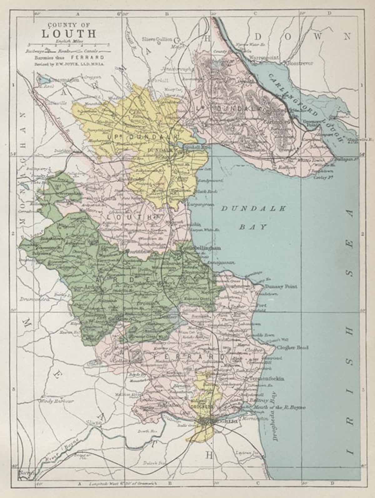
Description of County Louth | Drogheda | St. Lawrence's Gate, Drogheda | Mellifont Abbey | Celtic Cross, Monasterboice | Louth Map